For centuries, the Confederated Tribes of the Chehalis have lived in partnership with this important river and the fisheries it provides. Will Lewis County listen to them, or ignore history—and dam the Chehalis?
Some 170 years ago, the tribes who had long lived near the Chehalis River noted an influx of white families moving into the basin. For settlers arriving in summer, the river must have been a lovely sight: braided, gentle, and latticed by meadows.
“One of the first white families, the Fords, wanted to build a home right by the banks,” says Dan Penn, Tribal Historic Preservation Officer for the Confederated Tribes of the Chehalis Reservation. “We said, ‘you know, you seem like nice guys, so hey, this is a nice spot now, but look over here.’”
According to Penn, the Chehalis people pointed the Fords to a rise, still called Ford’s Prairie, safely above the river’s wild and frequently flooded winter floodplain. But not everyone heeded the Chehalis tribes’ advice. Instead, many of these white colonizers wrested predictable profit from the land by changing it: building channels and levees to stake out farmland; logging water-filtering forests; and eventually infilling and paving prairies with big box stores and other urban development. (“Bricks in a bathtub,” as the saying goes.)
And yet, the 115-mile-long Chehalis River, which makes a wide curl east to Centralia before swinging northwest and emptying into Grays Harbor, still proves impossible to contain. That’s a lesson Lewis County learned the hard way in 2007, when the region experienced its worst flooding in recorded history; water inundated the area, closed an adjacent stretch of Interstate 5 for days, and cost at least $166 million in economic damages. As the Northwest’s main commercial artery, I-5’s closure, in particular, meant the flood’s impact reverberated throughout the region.
To fix the problem, Lewis County’s recently formed Chehalis River Basin Flood Control District is doubling down on containment. It wants to build a new dam on the Chehalis, one of Washington’s most important salmon and steelhead rivers. If built, the dam would soar 24 stories and span the length of three football fields across the river above the town of Pe Ell.
But the Chehalis Tribe, local watershed groups, and conservation groups including Wild Salmon Center—collectively the Chehalis River Alliance—say a Chehalis dams carries a price tag even bigger than its estimated $625 million in initial costs. To start, dam construction and ongoing temporary reservoir maintenance would flood six miles of key wild Chinook and steelhead spawning and rearing grounds above the dam, transform 700 acres of the upper watershed into a mudpit, and interrupt natural water flows that have, so far, kept voracious, invasive bass out of the upper basin. Meanwhile, the dam wouldn’t solve basin flooding; it only aims to reduce it.
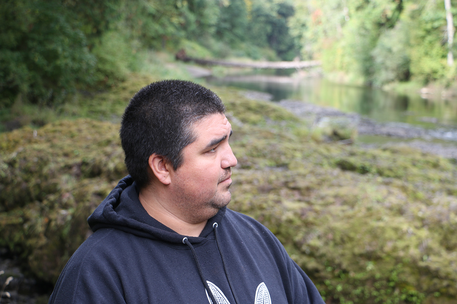
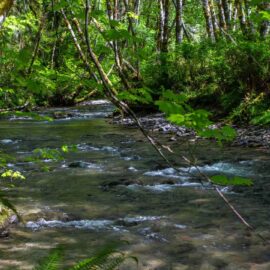
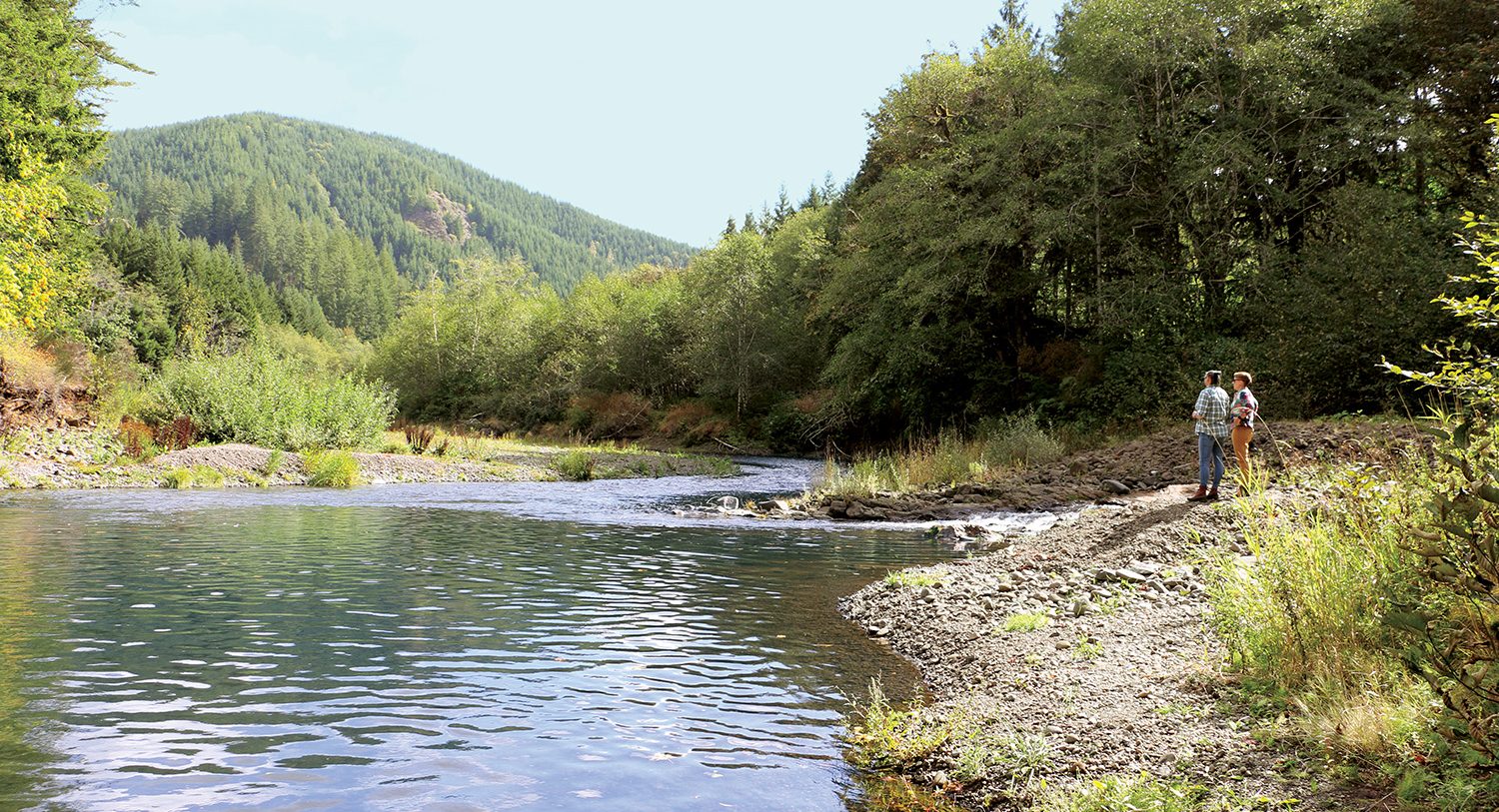
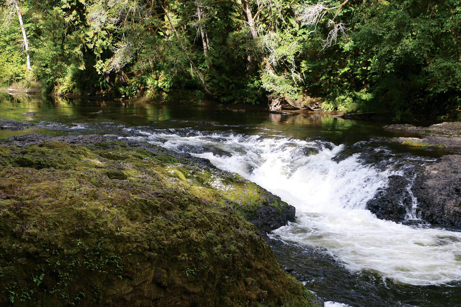
On a sunny September afternoon, Penn—along with WSC Washington Sr Program Manager Jess Helsley and Chehalis Tribe fish and wildlife biologist Hope Rieden—visited several sites along the Chehalis that the dam would impact. The first stop was Rainbow Falls, roughly 10 miles downriver from the proposed dam site. Penn explained that this is a sacred place for the Chehalis people, and a traditional harvest location for spring Chinook, steelhead, and lamprey. Standing above this five-foot cataract, Penn shared a Chehalis origin story of how Raccoon acquired his nimble hands—and then provoked the formation of the fall’s distinctive deep pools. Penn’s elders, he said, remember their families, just a few decades past, hopping into the Model T for nighttime lamprey harvests.
“The men used the treble hook to catch the eels,” Penn said. “It was the kids’ job to put them in the gunnysack.”
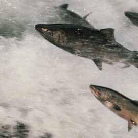
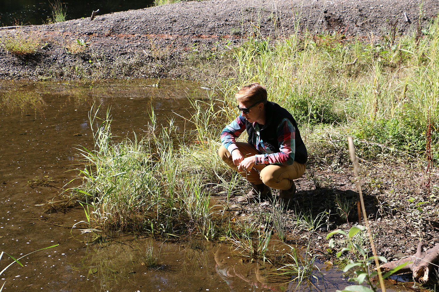
The Chehalis remains an important Chinook and steelhead river. But today, its spring Chinook are struggling, Rieden says: bad news for the Chehalis people, Lewis County sport fishers, and struggling Southern Resident orcas, just off the Washington coast, that depend on these once abundant runs. Rieden noted that the dam’s artificial flooding—regulated releases of the temporary reservoirs created by flood events—would make things worse, regularly washing out salmon and steelhead redds downstream, and altering water quality to the detriment of species beyond salmon. “What’s happening with spring Chinook could happen with lamprey,” she said.
Rieden’s job is to track ecologically important sites like this along the Chehalis. Penn, meanwhile, is racing against the clock to discover and catalog additional culturally important sites within the ceded homelands of the Chehalis people—before the proposed dam enters its next review phase in early 2020. For both Penn and Rieden, this work represents a young effort, as for decades government agencies withheld resources and official recognition due to the tribes’ “non-treaty” status.
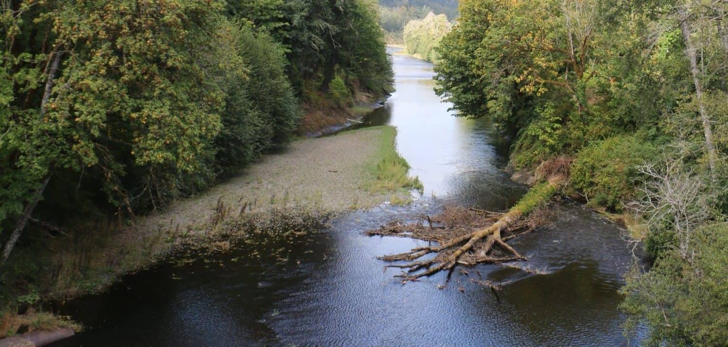
Halfway between Rainbow Falls and the proposed dam site, the group made another stop, at a 21-acre property recently purchased by the Chehalis. Here, they bushwhacked through a meadow of tall grass and volunteer apple trees to the river, navigating its steep, flood-cut banks. For long minutes, the trio stood rapt, watching baby salmon and trout race in the shallows. No one, at least, will build in this stretch of floodplain, said Penn; with the tribes’ growing clout in the region, the Chehalis are committed to securing plots of habitat that can just be.
This response to flooding—to encourage the river’s natural function, and build outside the floodplain—informs an emerging, ecologically-sound alternative plan to the dam. This alternative, as WSC’s Helsley explained it, involves expanding the natural floodplain in the lowlands, restoring the upper basin’s heavily-logged forests, and flood-proofing developments, like I-5, that can’t be moved. For Penn, it’s common sense; reflective of the relationship his people cultivated with the river for centuries.
“It’s interesting to think about taming a river,” Penn said. “It has a better understanding of how to be a river than anything we can come up with. It’s been a river for a long time.”
“It’s interesting to think about taming a river,” Penn said. “It has a better understanding of how to be a river than anything we can come up with. It’s been a river for a long time.”