With a lengthy and large wetland restoration project complete, life should be better for town and fish.
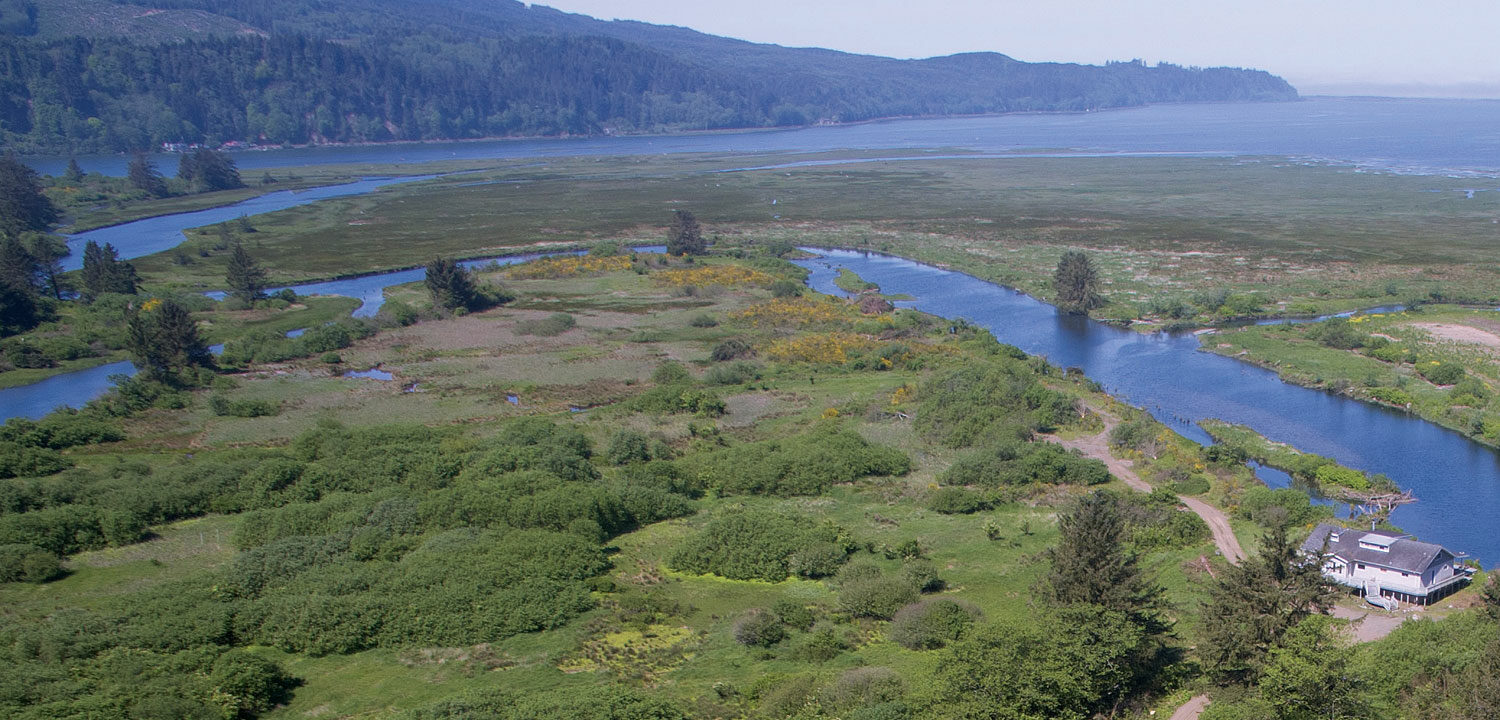
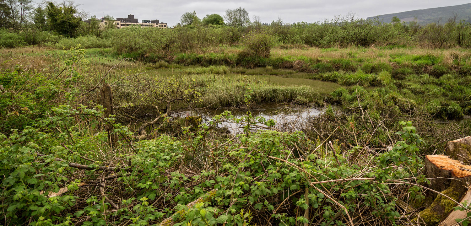
On December 2, Paul Levesque stood with dignitaries in a cold rain atop a layer of muck on one of the country’s most storied dairy landscapes to celebrate a long-awaited milestone: the completion of Oregon’s largest ever tidal wetland restoration project. About 10 % of the bay’s historic wetlands – 521 acres in all – have been opened up to create both a refuge for threatened coho and beleaguered Chinook salmon and an outlet for chronic flooding at the juncture of three rivers that tumble out of the coast range.
The ribbon fell at the small project ceremony.
I asked Levesque, the county project manager, exactly how long he’d been waiting for this.
“When was the last flood?” he shot back.
December 2007 ̶ the year that local floods crested at 20 feet?
“No, the Biblical one,” he cracked.
It has actually been 16 or 17 years, depending on who is counting. Good change takes a long time.
It also took $12.5 million, a mix of federal, state, and private dollars. It took a lot of trust building. A boatload of complex conceptual designs and nighttime work sessions to find the sweet spot for fish habitat and stormwater drainage.
And it took one thing that is in steep decline across the land – the willingness among competing factions to compromise.
“It was some classic compromising to get this over the hill,” said Chad Allen, a local dairyman who owns lands at the center of the project site.
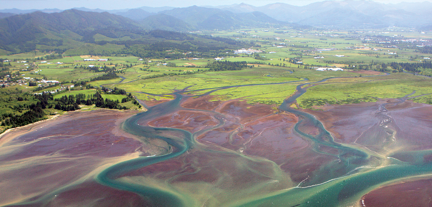
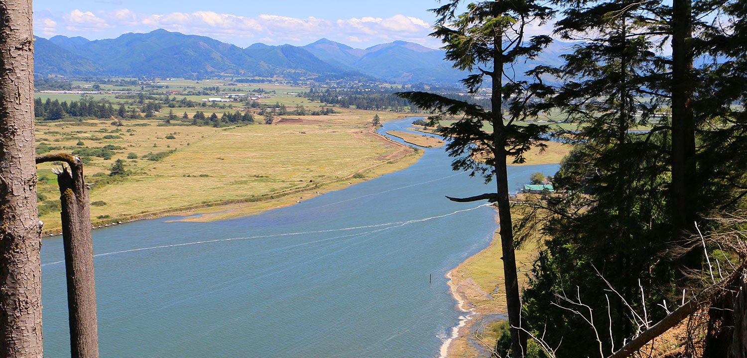
Flood control has long been an issue with no simple solution in Tillamook. Looking at an aerial shot of downtown, it’s not hard to see why. The city sits on low lying land at the confluence of the Wilson, Trask, and Tillamook rivers. Diking wetlands beginning in the early 1900s allowed good forage for the cows that feed the region’s world famous creamery. But as floodwaters roar west out of the mountains, they’re held up by the dikes, deepening the sheet of water flowing through the city.
“It creates a bathtub here,” said Levesque.
A decade and half ago, fish and wildlife advocates – backed by an extensive Army Corps of Engineers study ̶ began a process seeking to remove dikes and restore natural wetlands, for reduced flooding and improved habitat. Meanwhile, flooded business owners along Highway 101 had formed their own group to address stormwater concerns.
By 2001, a focused effort to acquire current and former dairy lands in the low-lying river estuary caused a local uproar. Would the state take ownership of these lands? Would the loss of dikes affect surrounding lands and cause them to flood? Would the loss of farmland – even from willing sellers – fly in the face of the Tillamook County Creamery Association’s policy of no net loss of dairy land?
“There was a lot of confusion, distrust, and general concern,” says Lisa Phipps, executive director at the Tillamook Estuaries Partnership, a local stewardship group that’s part of a national estuary program. “It was what you would expect when we talk about taking down levees.”
As the state agencies’ coordinated response program, Oregon Solutions, got involved, the project swung toward prioritizing flood control. Eventually, with a total of three federal agencies and the foundation of conservative activist Loren Parks joining the effort, fish and wildlife advocates saw that habitat restoration entered back into the picture.
To win support of Tillamook’s most powerful industry, the project team excised 85 acres of active, high-value farmland out of estuary restoration plans and agreed to protect it with reinforced levees.
The resulting plan went by the compromise-infused, bureaucratically correct name of “Southern Flow Corridor – Landowner Preferred Alternative.” It mixed re-wilding and heavy engineering.
To guarantee local control, Tillamook County was now the owner of the land and project. And it was up to Paul Levesque, the bearded, wry former fisherman and carpenter turned county chief of staff, to get the job done.
“I called it whack a mole,” he said.
To start, FEMA required a lengthy federal environmental impact study to sign off for $3.7 million in agency funds. He then adjusted the daily and seasonal work schedule to accommodate a federally protected bald eagle’s nest. He added toxic waste cleanup to the project to deal with a legacy veneer plant that had spread machine-oil laced sawdust into some local sloughs. And surveys found an old tribal village that needed a full-time cultural monitor during the construction phase.
Levesque, now 68, has never been a kayaker or birder or sport fisherman (and a commercial fishing accident disabled much of his left hand). But the rejuvenation of the landscape won him over even as it held up his retirement.
He stood rapt this past year as eaglets in that nest fledged and took their first flight. “They got so big, they destroyed the nest and they had to fly to the tree next door,” he said recently while glassing that tree with binoculars in search of the birds.
Out on the job site, work crews running dump trucks and front loaders to knock holes in dikes and put in new floodgates have been absorbed by the place and its evolution.
“It’s a muddy mess but it’s pretty cool to be part of,” said Scott Burks, the project’s foreman with Thompson Bros. Excavating. “This rock we’re taking out was put here by a friend of mine.” In old trees killed in ancient tsunamis and left in the former mud flats, “we’re discovering a lot of history. And I’m finding out that people actually like to watch birds!”
One of Burk’s crew became obsessed with a gaggle of ducklings roaming the site. “He had everyone frozen the other day. ‘Stop work. We got baby ducks.’”
Dairyman Chad Allen, an early skeptic of the project, eventually came around to support it because of promises to reduce flood levels by a foot and a half as they pulse through both low lying farm fields and businesses along Highway 101. (During October’s torrential rains ̶ an early test of the project ̶ Phipps, the estuaries partnership director, says the floods moved through town and out to Tillamook Bay more quickly.)
Allen was still tinkering with the new tidegates in mid-December to get his land to drain properly – the massive project still has some kinks to work out. But he’s seeing the upside over the long term, for floods and fish.
“What’s important for Tillamook County is also successful fish runs,” Allen said. “The reality is (industry) could be regulated more,” if fisheries don’t recover in the eyes of federal regulators. And that would increase costs. “We want to invest in restoration that’s compatible with flood control.”
Fourteen miles of new side channels and sloughs will be a boon to juvenile coho salmon, which are particularly sensitive to habitat change because they spend up to a year in river systems. Scientists say in as little as two years, adult salmon numbers could respond upward. A five-year scientific monitoring program on the project site will document their use of the restored wetlands.
“Where you restore 500 acres of habitat, we would expect to see a contribution to coho in the Tillamook estuary,” said Kim Jones, a retired state fisheries biologist, who has documented the rebound of coho populations on Oregon’s Salmon River, north of Lincoln City, after the estuary was undiked and restored there.
Chad Allen himself will be watching for returning fish. They’re expected in Blind Slough, a newly reopened back channel that his family had owned. “We’re looking forward to the transformation out there,” Allen said.
A transformation well worth the wait.
Wild Salmon Center helped the Southern Flow Corridor project to secure purchase options for land acquisitions and federal funding for restoration.
Photos provided by Tillamook Estuary Partnership, Tillamook County, Ross Photography and Boxcar Assembly, LLC.